Florida Memory is administered by the Florida Department of State, Division of Library and Information Services, Bureau of Archives and Records Management. The digitized records on Florida Memory come from the collections of the State Archives of Florida and the special collections of the State Library of Florida.

State Archives of Florida
- ArchivesFlorida.com
- State Archives Online Catalog
- ArchivesFlorida.com
- ArchivesFlorida.com
State Library of Florida
Related Sites
8 items found
| Identifier | Title | Type | Subject | Thumbnail | |
|---|---|---|---|---|---|
| fmc0258a | Map of East and West Florida, 1765 | Florida--Maps--To 1800. | /FMP/maps/thumbnails/fmc0258a.jpg | ||
| fmc0262 | Map of East and West Florida, 1765 | Florida--Maps--To 1800. | /FMP/maps/thumbnails/fmc0262.jpg | ||
| fmc0297 | Map of Florida, 1657 | Cities and towns--Florida--Maps--To 1800. Cities and towns--Southern States--Maps--To 1800. Rivers--Florida--Maps--To 1800. Rivers--Southern States--Maps--To 1800. Florida--Maps--To 1800. Southern States--Maps--To 1800. | /FMP/maps/thumbnails/fmc0297.jpg | ||
| fmc0263 | Map of Spanish Florida, 1768 | Manuscripts--Facsimiles. Florida--Maps--To 1800. Gulf Coast (U.S.)--Maps--To 1800. | /FMP/maps/thumbnails/fmc0263.jpg | ||
| fmc0265 | Map of West Florida, 1772 | Florida--Maps--To 1800. Gulf Coast (U.S.)--Maps--To 1800. | /FMP/maps/thumbnails/fmc0265.jpg | ||
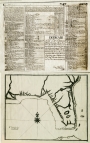
| fmc0143 | Port St. Augustine, 1783 | Harbors--Florida--Saint Augustine--Maps--To 1800. Saint Augustine (Fla.)--Maps--To 1800. Florida--Maps--To 1800. | /FMP/maps/thumbnails/fmc0143.jpg | ||
| fmc0259 | Stockdale's Map of East and West Florida, 1794 | Florida--Maps--To 1800. | /FMP/maps/thumbnails/fmc0259.jpg | ||
| fmc0261 | Tardieu's Florida and Georgia, 1780 | Early maps. Southern States--Maps--To 1800. Florida--Maps--To 1800. | /FMP/maps/thumbnails/fmc0261.jpg |